Features Quy Hoạch TP.HCM
Main functions of the application:1.
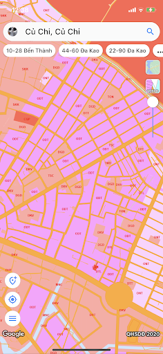
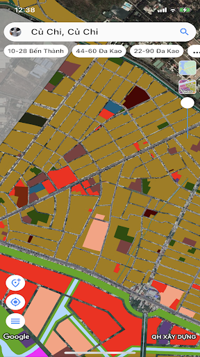
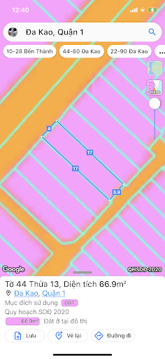
Determine whether the users current land plot is subject to planning or not.2.
Look up planning information by:• Enter the number of map sheets and land plots on the land use rights certificate and other related documents.• Enter the coordinates of the land plot that the user wants to look up• Take a photo of the coordinates of the land plot that the user wants to look up3.
View information by clicking directly on the map.4.
Save land plot information.Note:The app does not represent any government agency.All data provided by the application comes from the national open data portal source - data.gov.vn and other links provided from there.
Camera Features
Advanced camera features with editing capabilities.
See the Quy Hoạch TP.HCM in Action
Get the App Today
Available for Android 8.0 and above